Isle au Haut Lighthouse
Location: Isle Au Haut
Latitude: 44°03'53.1"N Longitude: 68°39'04.9"W
Latitude: 44°03'53.1"N Longitude: 68°39'04.9"W
Station Established: 1907
Automated: 1934
Structure Status: Standing
Tower Height: 40 Feet
Focal Plane: 47 Feet
Present Day Optic: 250mm lens
USCG Unit Responsible for Aid to Navigation: USCGC Bridle
Historic Structures Remaining: 
1907 keeper's house
1907 boathouse
1907 oil house, outhouse
Lighthouse Owner: Town of Isle Au Haut
Lighthouse Managed By:
Isle au Haut Lighthouse Committee
Isle au Haut Lighthouse Committee
P.O. Box 41, Isle Au Haut, ME 04645
http://www.isleauhautmaine.us/lighthouse-committee/
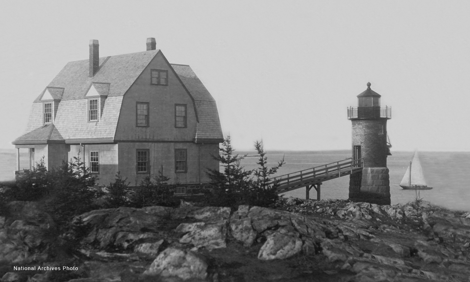
Isle Au Haut Lighthouse - National Archives